
Software
SMART ALARM
SmartAlarm is a software module developed by Crisma Security for the management and display of geo-referenced alarms on a graphic map with automatic target tracking functionality.
SmartAlarm is able to interact with numerous intelligent field sensors by collecting the alarm events generated by the individual sensors and adding georeferencing information when necessary, providing the Video Management systems with an integrated view on an interactive map and advanced functions for managing alarms. .
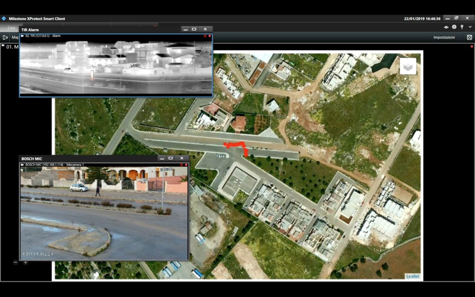
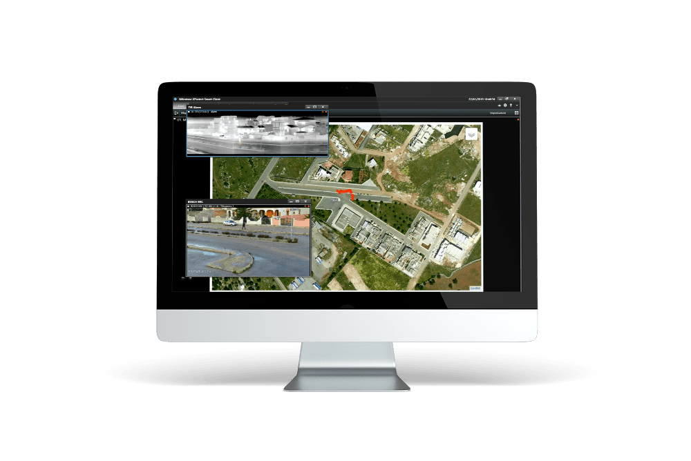
When an intruder is detected by one or more intelligent sensors, the system displays the number and location of the intruders on the map , at the same time an alarm event is generated which appears in the alarm list of the VMS. The system is also able to automatically track intruders through one or more PTZ cameras and drones. In this way, within the VMS there is an integrated view of the alarms, the images coming from the cameras and the position of the intruders on the map.
This information is very useful to security operators who must quickly analyze the event because they know precisely the location of the patrons, fundamental information for large critical infrastructures.
Smart Alarm demo
Integrate geo-referenced alarms into the VMS system
SmartAlarm receives alarm information from different types of sensors including intelligent thermal and visible cameras, thermal radar, radar, microphone and motion sensors, transforms it into a standard format and sends it in an intelligible format to the video management system.
When the alarm event reaches the VMS, in the configuration of the VMS itself, it is possible to make a correlation of the alarm with the cameras to which the alarm is associated.
This arrangement allows security operators to view the list of alarms in the Video Management system and with a simple click you can access the video clips recorded relating to the alarm.
In addition to sending the alarm information, SmartAlarm provides the VMS with a static or dynamic map of the site on which the alarms are graphically represented.If you use Google Maps you can use the double display mode: graphic or satellite.
This map can be incorporated directly into the client of the Video Management system in order to have total control of the site : on the one hand the list of alarms is displayed, on the other the map showing the geo-referenced alarms detected by the sensors.
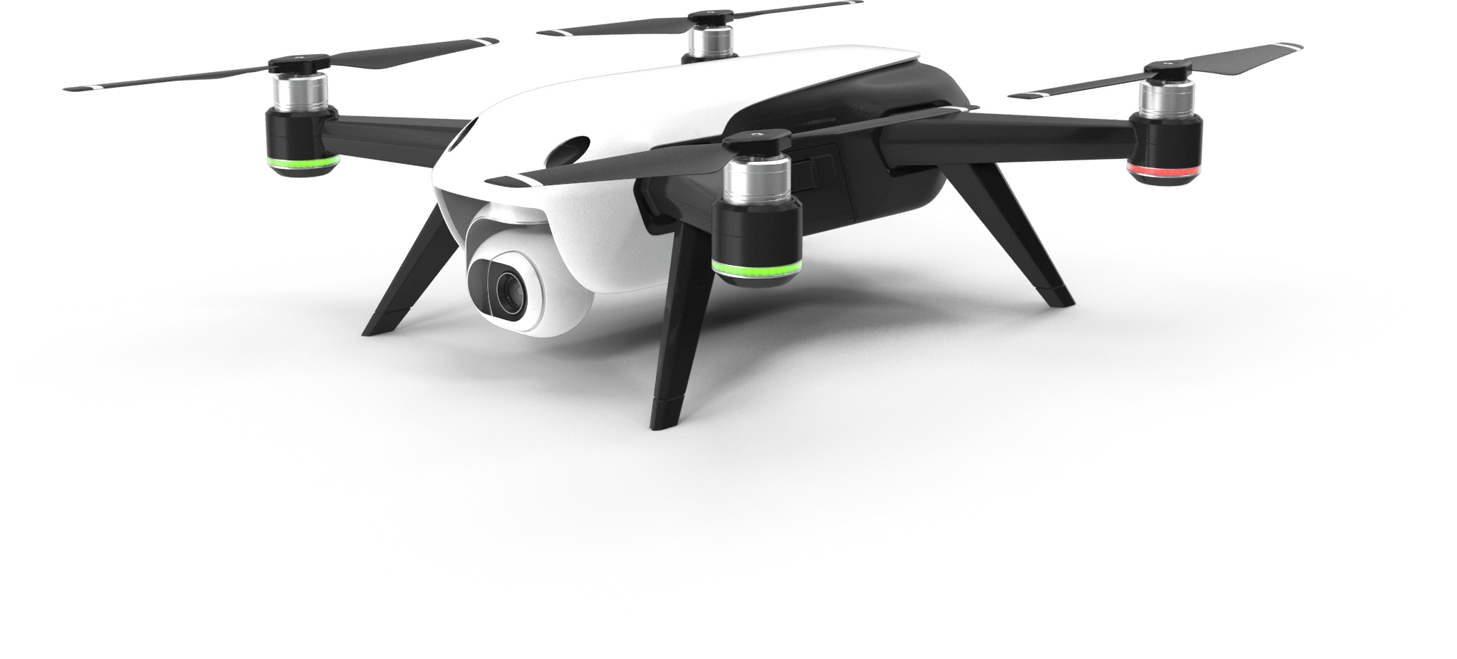
Tracking with Drones
The automatic target tracking functionality with DJI drones is included within the SmartAlarm software module.
When an intelligent sensor detects a target, SmartAlarm receives the GPS coordinates of the target itself in real-time and checks the flight plan of a DJI family drone that supports the mobile SDK.
The flight information is updated in real-time taking into account the current position of the drone and the position of the target to be followed, the system is able to manage take-off, flight plan and landing automatically .
In compliance with ENAC regulations, these activities must in any case be supervised by an operator who, in case of need, is able to take control of the drone through the supplied remote control, unless specific authorization from ENAC.
The map of obstacles in the flight area with the indication of the no-fly areas, the permitted flight heights (minimum and maximum height) are also defined for the areas allowed to fly, on the basis of this information the system calculates the best flight plan to perform automatic tracking of the target.
The images coming from the drone camera can be acquired and sent in real time to an external VMS . This can record them and display them live together with those of the other cameras and the geo-referenced map, to provide the user with a complete picture of the situation.
Tracking with PTZ cameras
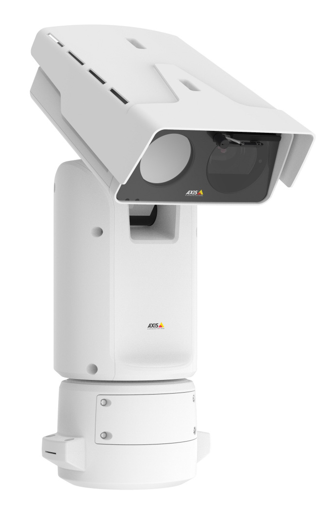
SmartAlarm receives alarm information from different types of sensors including intelligent thermal and visible cameras, thermal radar, radar, microphone and motion sensors, transforms it into a standard format and sends it in an intelligible format to the video management system.
When the alarm event reaches the VMS, in the configuration of the VMS itself, it is possible to make a correlation of the alarm with the cameras to which the alarm is associated.
This arrangement allows security operators to view the list of alarms in the Video Management system and with a simple click you can access the video clips recorded relating to the alarm.
In addition to sending the alarm information, SmartAlarm provides the VMS with a static or dynamic map of the site on which the alarms are graphically represented.If you use Google Maps you can use the double display mode: graphic or satellite.
This map can be incorporated directly into the client of the Video Management system in order to have total control of the site : on the one hand the list of alarms is displayed, on the other the map showing the geo-referenced alarms detected by the sensors.
ADVANTAGES OF THE SOLUTION
Integrated display of geo-referenced alarms on an interactive map
Automatic Tracking with PTZ cameras and drones
Simple integration with the main Video Management platforms
Compatible with Radar, Thermal Radar, Smart Cameras, Microphone and Motion Sensors
Advanced filters for the reduction of false alarms
Simplified operation for control room operators
Synchronized playback of map and cameras